Property Record
2000 Harbor Pines Dr, Saint Marys, GA 31558
NEARBY LISTINGS FOR SALE OR LEASE
-
-
View all Saint Marys listings for sale on LoopNet.com
Property Detail
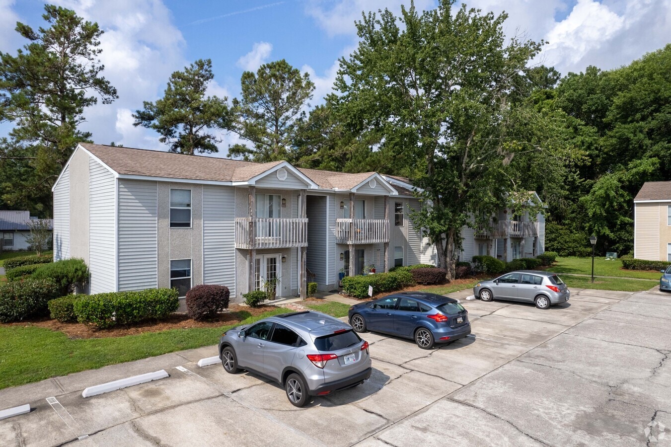
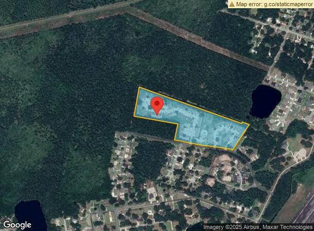
2000 Harbor Pines Dr
St. Marys, GA
County Commercial
148-033C
COMM (APTS)/L RETREAT AT HIDDEN BAY
Commercialnec
Camden
2024
Georgia
2024
13.84 AC
010604
Brunswick/Kingsland
9,744 SF
Other Market Areas
DEMOGRAPHICS near 2000 Harbor Pines Dr
1 Mile
3 Mile
5 Mile
2024 Total Population
2,641
16,834
25,726
2029 Population
2,890
18,323
28,083
Pop Growth 2024-2029
+ 9.43%
+ 8.85%
+ 9.16%
Average Age
35
37
37
2024 Total Households
1,085
6,360
9,286
HH Growth 2024-2029
+ 9.59%
+ 9.10%
+ 9.41%
Median Household Inc
$32,331
$61,933
$70,463
Avg Household Size
2.30
2.40
2.50
2024 Avg HH Vehicles
2.00
2.00
2.00
Median Home Value
$146,153
$250,770
$253,274
Median Year Built
1989
1992
1994
Nearby Places
- Restaurants
- Banks
- Shops
- Fitness
- Groceries
PUBLIC TRANSPORTATION
AIRPORT
Jacksonville International
DRIVE
WALK
Distance
Jacksonville International
45 min
30.2 mi
Freight Ports
Georgia Ports - Brunswick
DRIVE
WALK
Distance
Georgia Ports - Brunswick
52 min
37.2 mi
Nearby Properties
Address
Land Use
TOTAL SIZE
Lot Size
Zoning
Address
Land Use
TOTAL SIZE
Lot Size
Zoning
172,807 SF
45.10 AC
R-1
Address
Land Use
TOTAL SIZE
Lot Size
Zoning
115,682 SF
4 AC
C-1
Address
Land Use
TOTAL SIZE
Lot Size
Zoning
80,350 SF
28 AC
PD
Address
Land Use
TOTAL SIZE
Lot Size
Zoning
1,456 SF
15.71 AC
R-3
Address
Land Use
TOTAL SIZE
Lot Size
Zoning
64,810 SF
21 AC
R-1
Address
Land Use
TOTAL SIZE
Lot Size
Zoning
14,152 SF
14.25 AC
R-3
Address
Land Use
TOTAL SIZE
Lot Size
Zoning
1,143 AC
PD M-U
Address
Land Use
TOTAL SIZE
Lot Size
Zoning
3,240 SF
13.97 AC
R-1
Address
Land Use
TOTAL SIZE
Lot Size
Zoning
77,912 SF
12.76 AC
C-2
Address
Land Use
TOTAL SIZE
Lot Size
Zoning
28,858 SF
5.09 AC
R-3
Address
Land Use
TOTAL SIZE
Lot Size
Zoning
11,086 SF
6.26 AC
R-3
Address
Land Use
TOTAL SIZE
Lot Size
Zoning
6,720 SF
25 AC
R-3
Address
Land Use
TOTAL SIZE
Lot Size
Zoning
92,858 SF
10.67 AC
C-2
Address
Land Use
TOTAL SIZE
Lot Size
Zoning
451,960 SF
40.62 AC
I-G
Address
Land Use
TOTAL SIZE
Lot Size
Zoning
16,660 SF
10.72 AC
R-3
Address
Land Use
TOTAL SIZE
Lot Size
Zoning
4,052 SF
291.05 AC
I-A
Address
Land Use
TOTAL SIZE
Lot Size
Zoning
31,040 SF
4.48 AC
I-L
Address
Land Use
TOTAL SIZE
Lot Size
Zoning
12,656 SF
7.02 AC
R-3
Address
Land Use
TOTAL SIZE
Lot Size
Zoning
49,031 SF
5.29 AC
C-2
Address
Land Use
TOTAL SIZE
Lot Size
Zoning
1,911 SF
6.64 AC
R-3
Address
Land Use
TOTAL SIZE
Lot Size
Zoning
12,560 SF
4.93 AC
C-2
Address
Land Use
TOTAL SIZE
Lot Size
Zoning
25,920 SF
1.38 AC
C-1
Address
Land Use
TOTAL SIZE
Lot Size
Zoning
36,926 SF
6.02 AC
C-2
Address
Land Use
TOTAL SIZE
Lot Size
Zoning
4,849 SF
46.34 AC
C-2
Address
Land Use
TOTAL SIZE
Lot Size
Zoning
6,194 SF
3.48 AC
C-2
Address
Land Use
TOTAL SIZE
Lot Size
Zoning
38,304 SF
5.40 AC
I-L
Address
Land Use
TOTAL SIZE
Lot Size
Zoning
12,279 SF
1.67 AC
C-2
Address
Land Use
TOTAL SIZE
Lot Size
Zoning
1,530 SF
5.97 AC
C-2
Address
Land Use
TOTAL SIZE
Lot Size
Zoning
29,256 SF
3.58 AC
R-1
The World's #1 Commercial Real Estate Marketplace
Connect with us
© 2025 CoStar Group
The information above has been obtained from sources believed reliable. While we do not doubt its accuracy we have not verified it and make no guarantee, warranty or representation about it. It is your responsibility to independently confirm its accuracy and completeness. Any projections, opinions, assumptions, or estimates used are for example only and do not represent the current or future performance of the property. The value of this transaction to you depends on tax and other factors which should be evaluated by your tax, financial, and legal advisors. You and your advisors should conduct a careful, independent investigation of the property to determine to your satisfaction the suitability of the property for your needs.